SityTrail Premium Plus - annual subscription


🌍 Explore the world with SityTrail, your ultimate companion for all your outdoor activities
Whether you're a passionate hiker, avid cyclist, winter sports enthusiast, or simply looking for adventure and discovery, SityTrail accompanies you everywhere, anytime, with complete ease.
✨ Discover our FREE Freemium features:
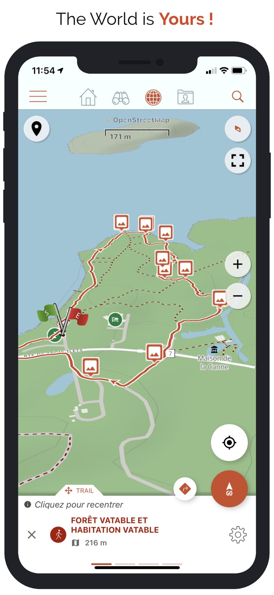
✅ Record your adventures
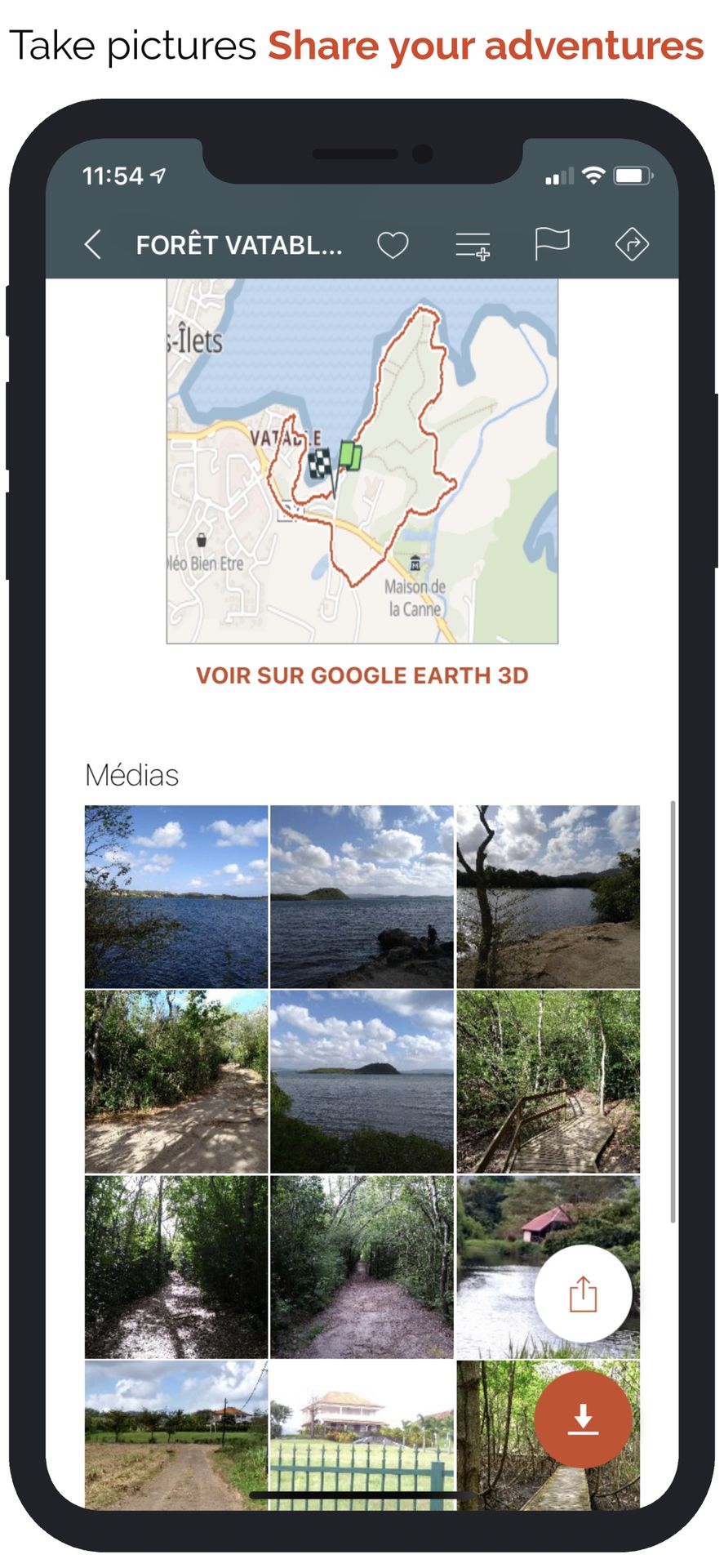
• Save your hikes with geotagged photos.
• Track your performance: distance, effort (Km-effort), average speed, pace, calories burned.
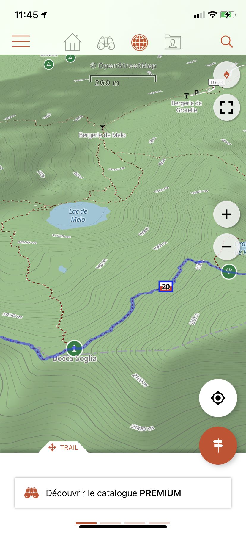
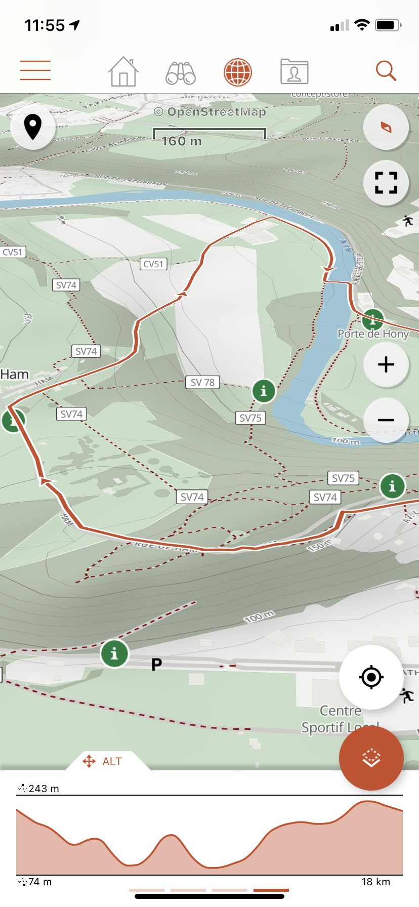
✅ Navigate safely
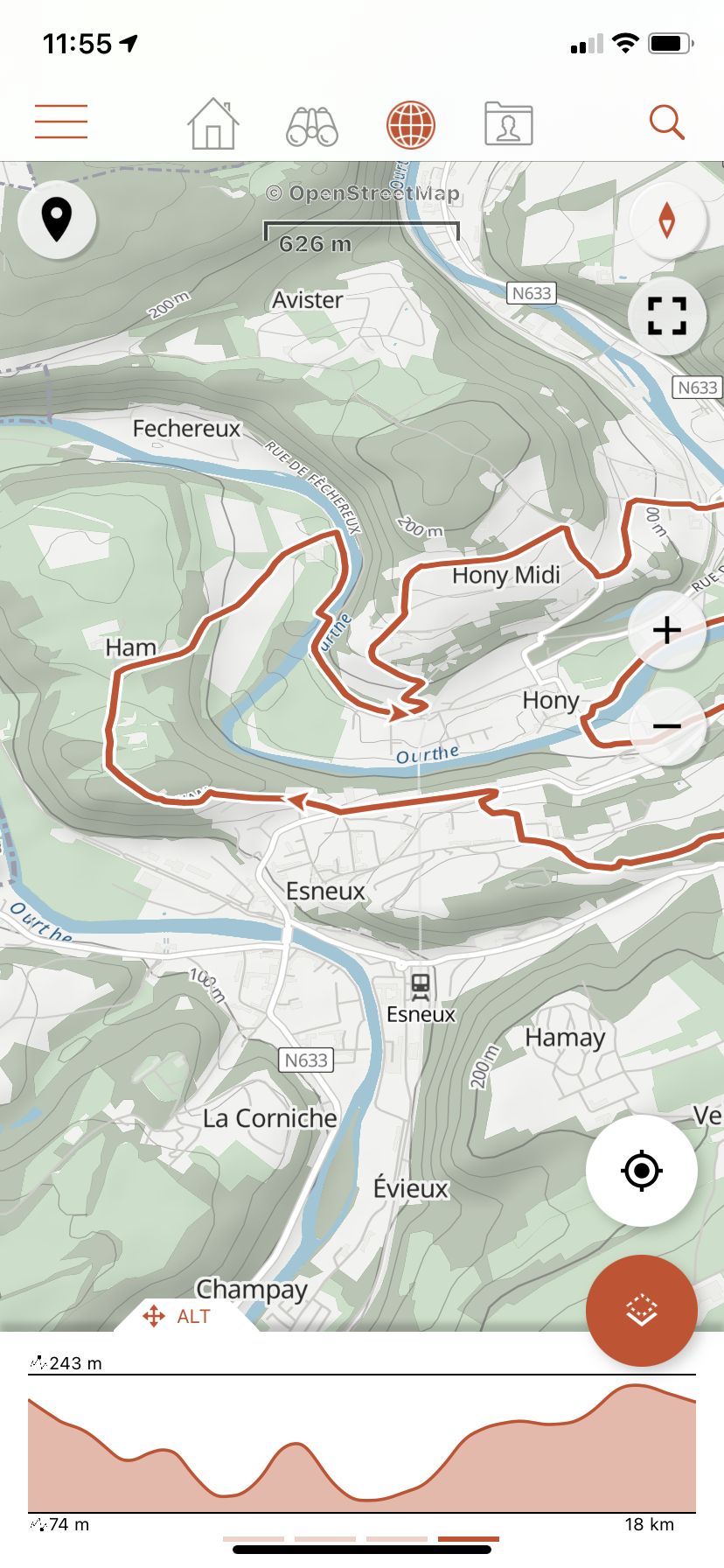
• Precise altimeter with interactive elevation profile.
• Automatic alarm if you stray from your route to avoid getting lost.
• Automatic activation of points of interest with voice descriptions.
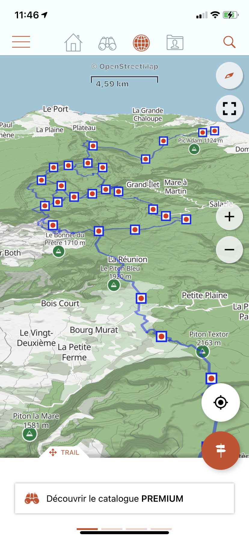
✅ Easily plan and share
• Create and edit trails and points of interest directly from our website.
• Access your projects online and instantly retrieve them on your Android or iOS smartphone.
• Sort and organize your favorite routes in personal lists.
✅ Universal access
• Create a free account to synchronize your data across all your devices.
• Discreet advertisements displayed only to finance our free servers.
🚀 Upgrade to Premium for unlimited adventures
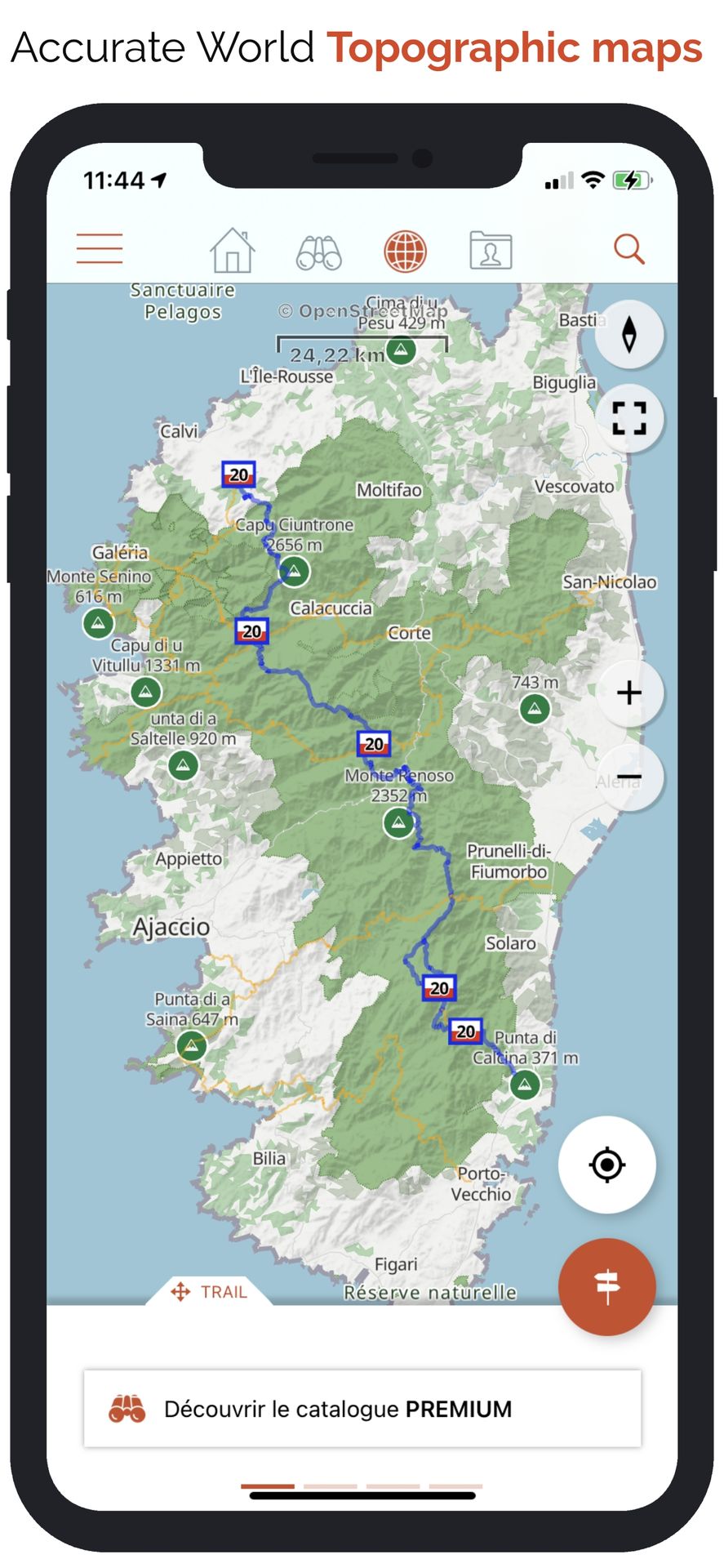
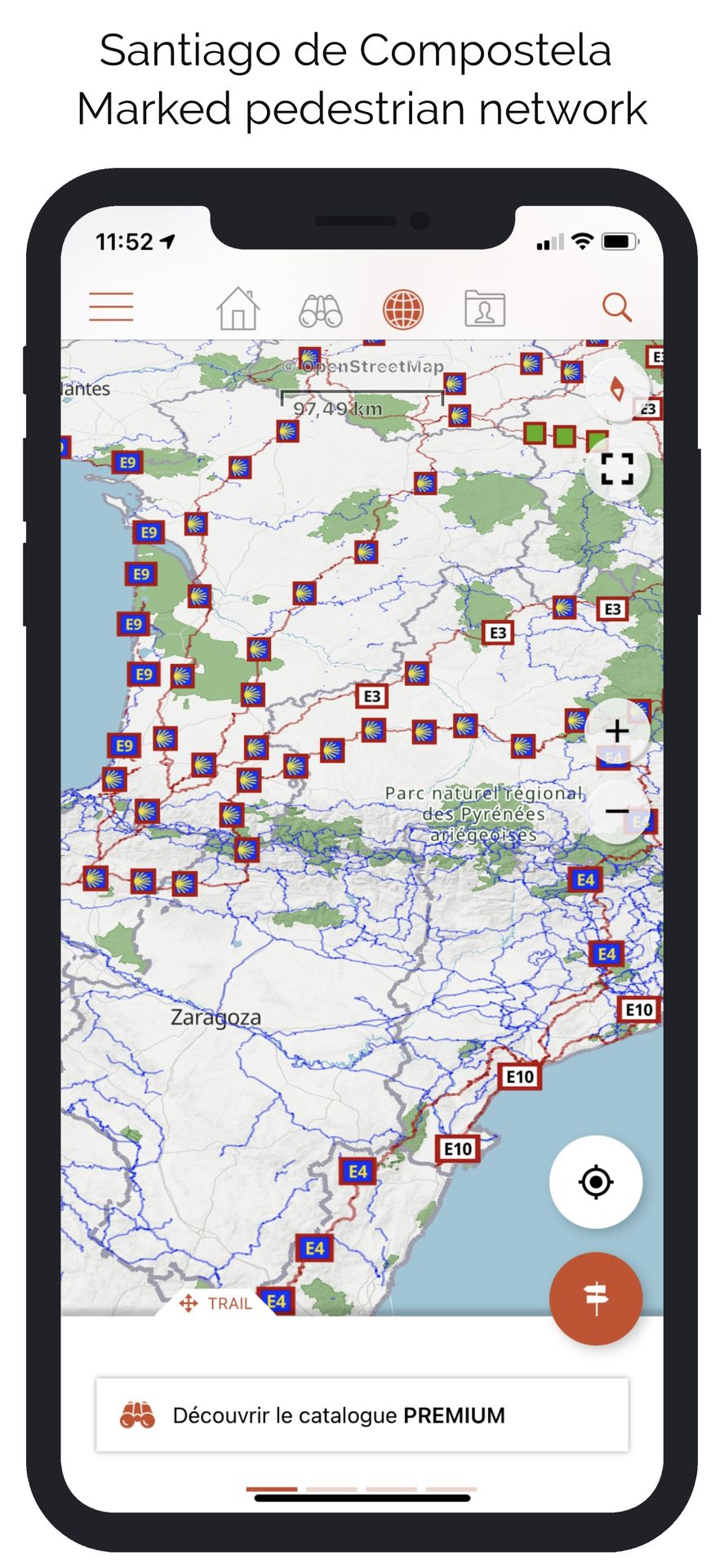
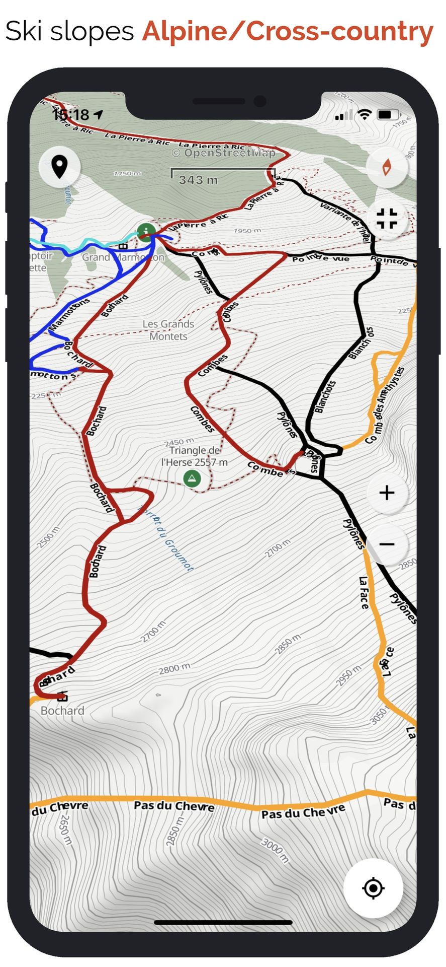
🌟 Premium maps and offline mode
• Download detailed topographic maps by area (IGN France, SwissTopo, Luxembourg, United Kingdom, and our worldwide Geolives topographic maps).
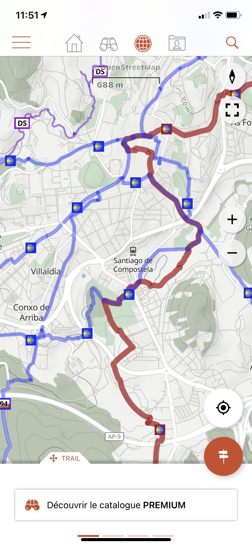
• Access the best hiking networks (GR, PR, European routes, Santiago de Compostela routes).
• Discover cycling routes (Voies vertes in France, Ravel in Belgium, Node networks in the Netherlands).
• Easily identify ski slopes by their colors and names.
🌟 Optimized guidance and safety
• Benefit from advanced vocal GPS guidance with precise Roadbook symbols.
• Let yourself be guided easily with clear visual symbols at each intersection or direction change. You'll always know exactly which trail to follow, even without technical knowledge!
• Easily estimate remaining distance and time with clear, realistic displays.
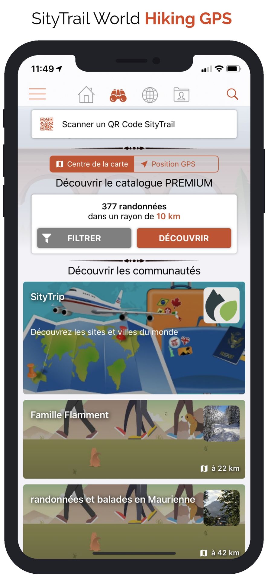
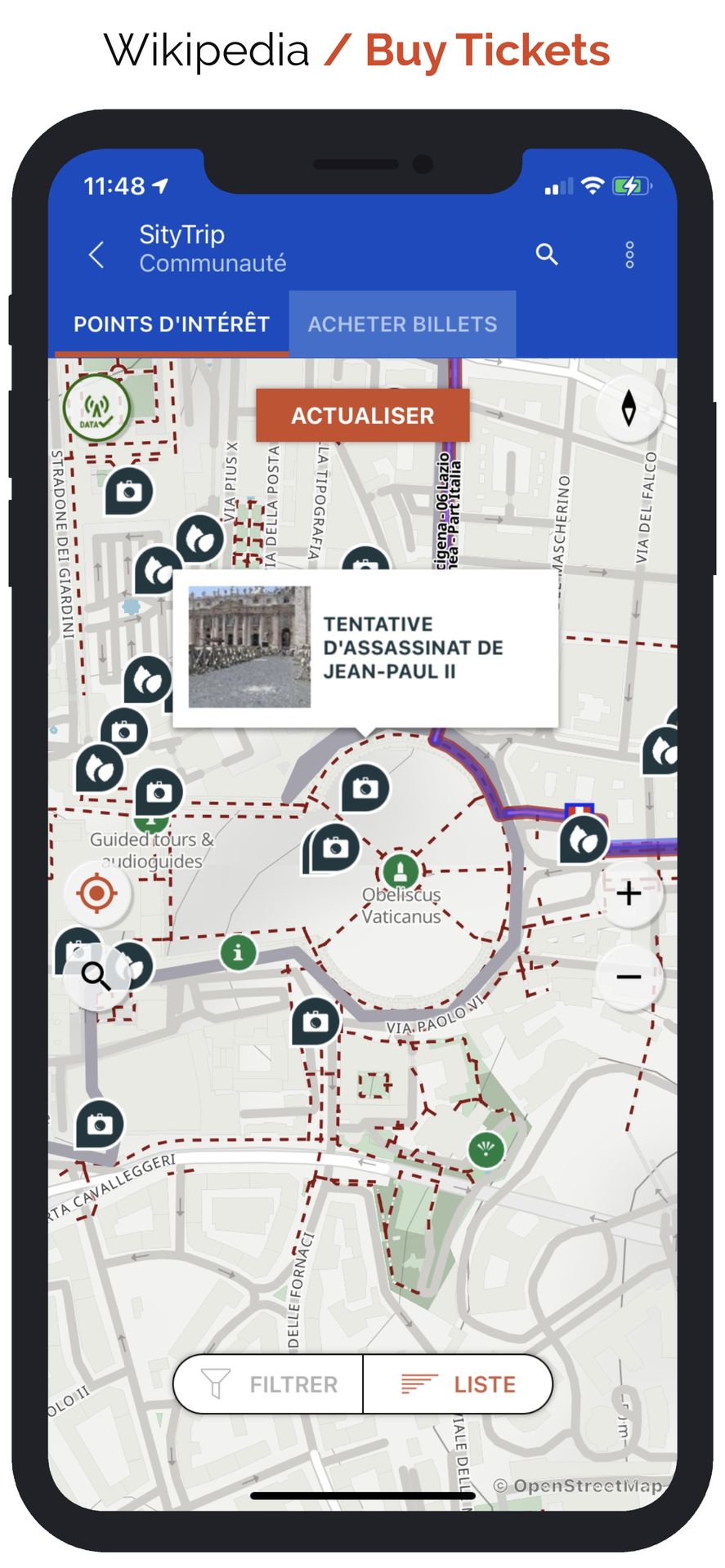
🌟 Active and collaborative community
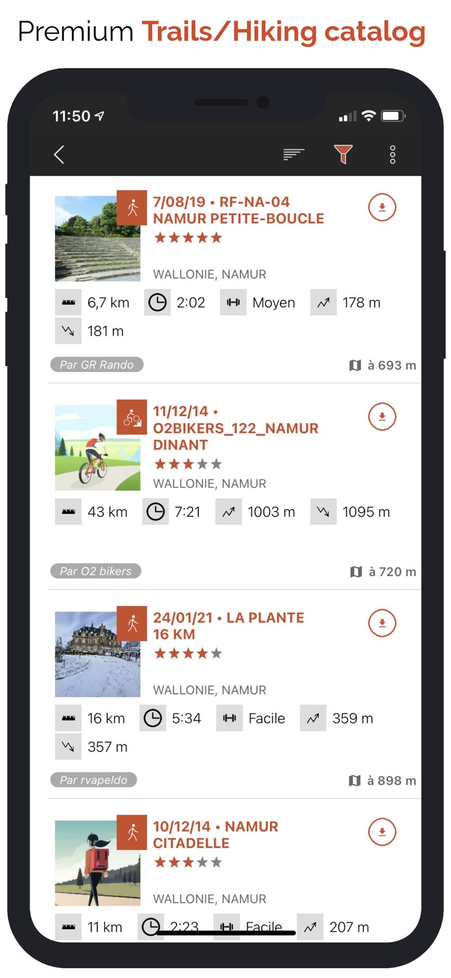
• Explore the public catalog of the community’s favorite trails.
• Transform your hikes into true multimedia guides enriched with texts, photos, and videos, and share them with other users.
• Create your own communities, easily manage members, and share your news.
🌟 Advanced editing and printing features
• Precisely edit your trails through our web platform.
• Easily print your hiking maps in PDF format (A4 or A3) with an integrated QR Code.
⌚ Compatible with your smartwatch
• Record and follow your trails directly from your Wear OS, Apple Watch or Garmin smartwatch, including remaining time estimates and realistic visual guidance with accurate Roadbook symbols!
⚠️ Important information:
• Some features require an internet connection.
• Prolonged GPS use may decrease battery life.
🚶♂️🚴♀️🎿 With SityTrail, fully enjoy your outdoor passions and discover new horizons with every outing!