SityTrail Premium USA - yearly subscription


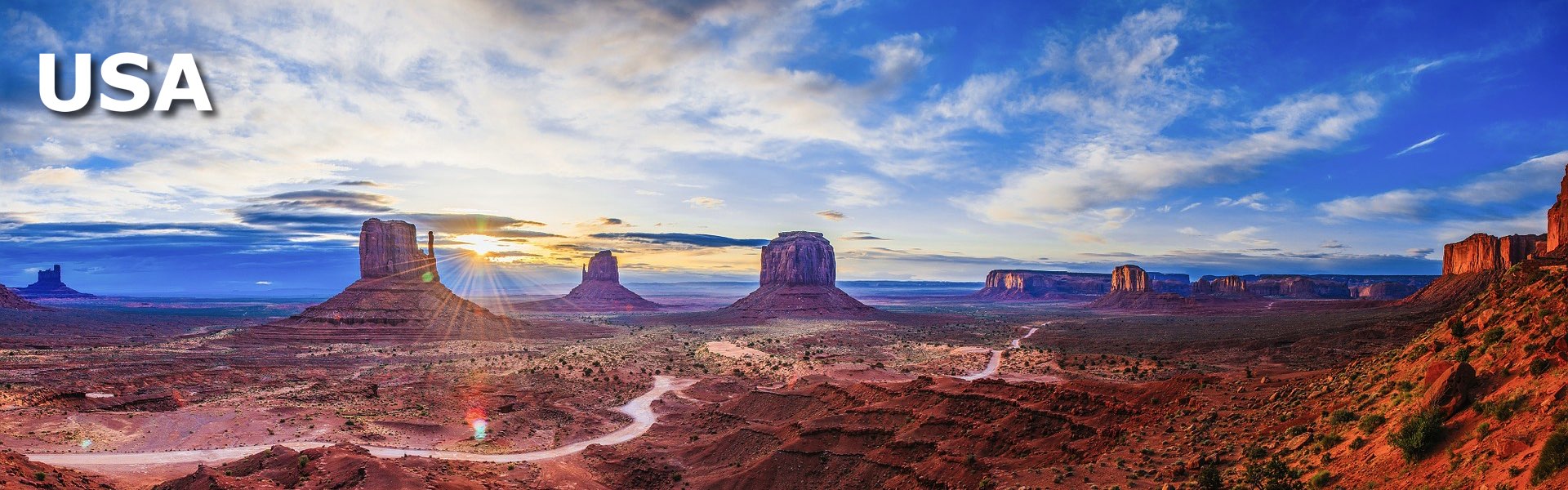
The United States, a vast country in North America, offers numerous opportunities for outdoor enthusiasts. With diverse landscapes ranging from majestic mountains in the West to vast forests in the East, as well as expansive deserts and stunning coastlines, the United States is a true paradise for hiking, cycling/MTB, and outdoor activities in general.
Hiking is a highly appreciated activity in the United States, and the country is home to an abundance of well-maintained hiking trails. Iconic national parks such as the Grand Canyon, Yellowstone, and Yosemite offer a variety of hiking routes, allowing hikers to discover breathtaking views, unique geological formations, and fascinating wildlife. Whether you're looking for a day hike or embarking on a long adventure on the Appalachian Trail or Pacific Crest Trail, the United States offers endless opportunities for hikers of all levels.
Cycling and mountain biking are also very popular in the United States, and the country boasts an extensive network of bike paths and mountain bike trails. Vibrant cities like Portland and San Francisco offer urban bike lanes, while destinations like Moab in Utah or Sedona in Arizona are renowned for their diverse mountain biking trails and spectacular landscapes. Whether you want to explore the national parks by bike, go mountain biking in the Rocky Mountains, or ride scenic coastal trails, the United States has something to offer every cycling enthusiast.
In addition to hiking and cycling/MTB, the United States offers a multitude of other outdoor activities. National parks, lakes, rivers, and coastlines are perfect for camping, fishing, kayaking, canoeing, rafting, and many other water sports. Climbing enthusiasts will find exciting challenges in the mountains of the West, while birdwatchers can explore the country's many preserved habitats in national parks and nature reserves.
In summary, the United States is a true paradise for outdoor enthusiasts. With its vast natural landscapes, renowned national parks, and endless opportunities for hiking, cycling/MTB, and outdoor activities in general, the country offers an unforgettable experience for adventurers seeking connections with nature.
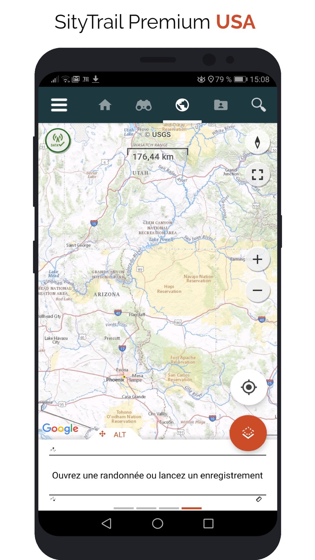
This subscription provides access to the following map types:
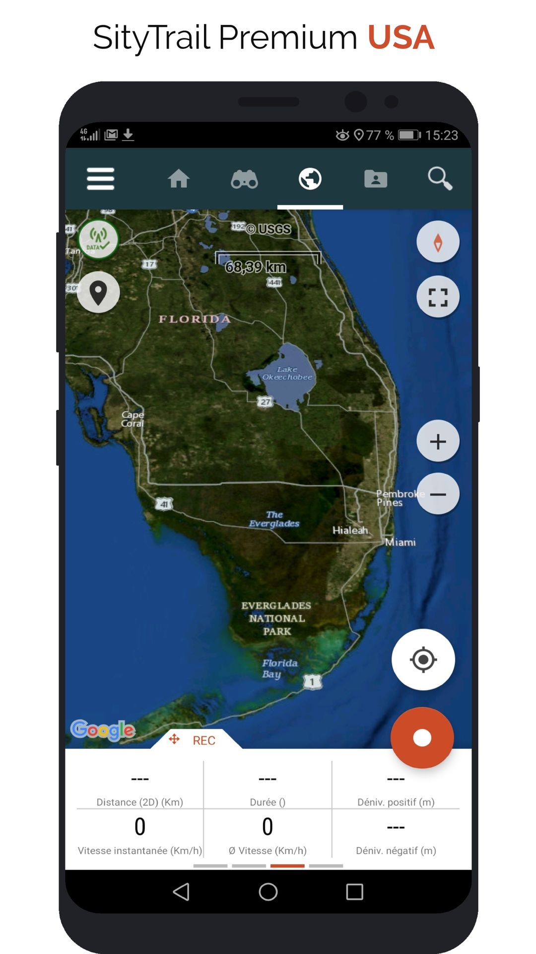
- USA - Topographic maps
- USA - Satellite
- USA - Satellite + topo
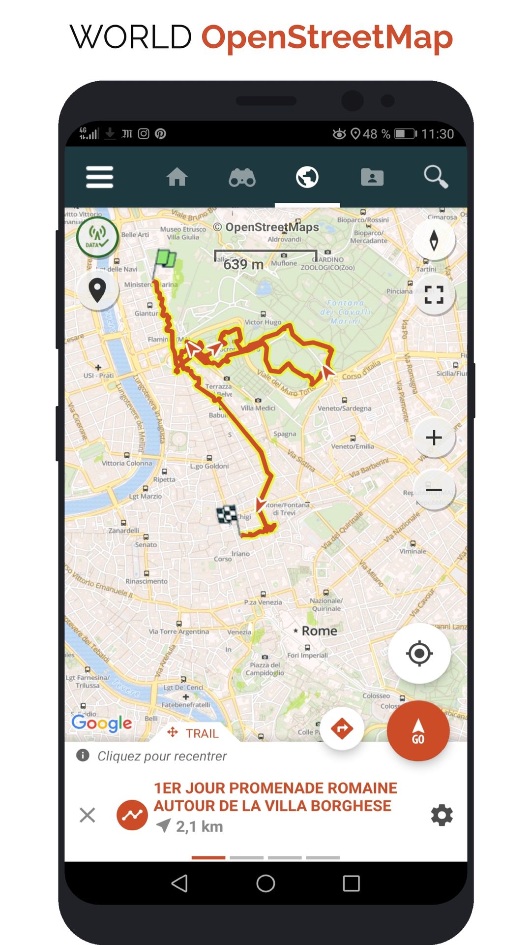
- New: OpenStreetMap world maps
- New: A map of slopes around the world
It also enables Premium features in Web and mobile applications:
- Download topographic maps for offline use.
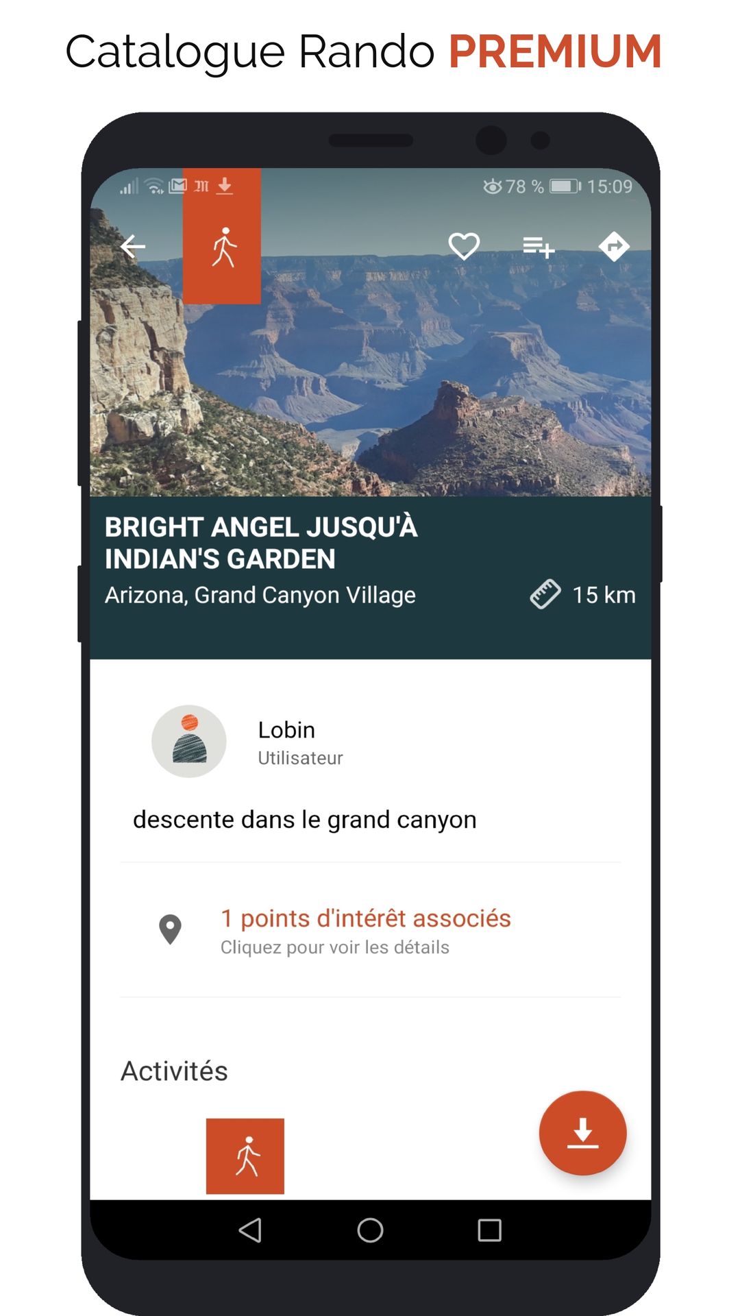
- Access the public catalogue of trails from SityTrail members and communities.
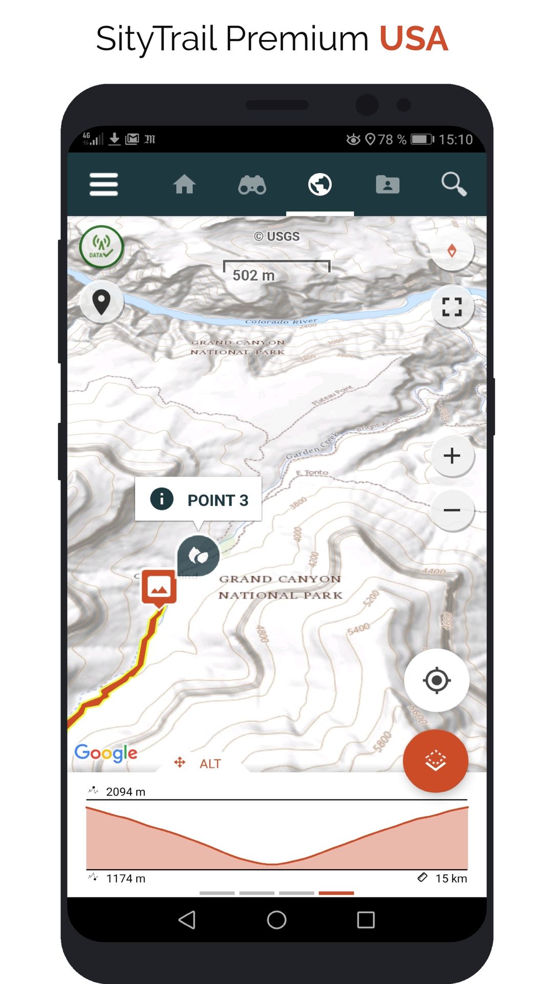
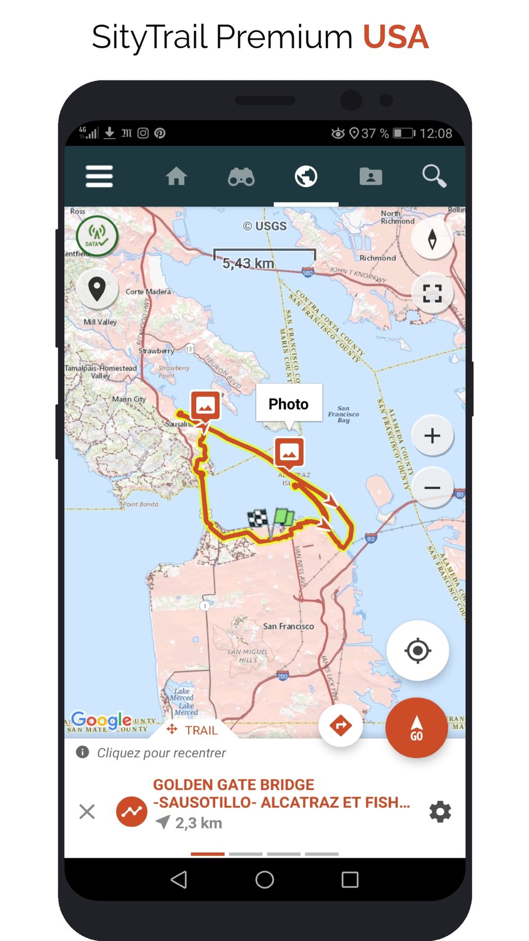
- Advanced tracking and guiding features with calculation of the remaining distance and time and vocal instructions at intersections.
- Create your own hiker communities and manage your members and newsfeeds.
- Create trails with our advanced features for trail editing via our website : automatic drawing, merging and splitting of trails, etc.
- Print trails in PDF format with QR codes. (A4, A3).
- Export GPX and KML files.
- Priority technical support.
- Remove ads in the mobile application.
- "SOS" feature.
- Visualization of a hike on a map in 3D mode (terrain with elevation)
- Beacon or tagging function allowing you to share your GPS location with your loved ones.